APN Number Meaning: What an Assessor’s Parcel Number Is

APN stands for assessor’s parcel number. It is the identification number a county assessor assigns to a parcel of real property so the parcel can be tracked for assessment and property tax. Cornell Law School’s Wex defines APN as shorthand for exactly that. If you invest in real estate, the APN is the cleanest key you have for pulling up one specific property in county records, without mixing it up with the house next door or the lot with a similar address.
This guide explains what the number means, what the digits can tell you, how it differs from a tax ID or parcel ID, where to find it, and what it cannot tell you. It also shows how investors use it when they analyze deals.
TL;DR
- APN means assessor’s parcel number: a number the county assessor assigns to each parcel for identification and record keeping.
- APNs are issued by counties, and the format varies from county to county, so the same number can look very different in different places.
- Find yours on a tax bill, valuation notice or deed, or search the county assessor’s website by address.
- An APN points to a parcel. It is not a legal description and it does not define property lines.
- Investors use the APN to match the right property to comps, tax records, owner data and zoning research.
Table of Contents
- What does APN mean in real estate?
- What an APN is used for
- How to read the digits of an APN
- Is an APN the same as a tax ID, parcel ID or folio number?
- Are APNs unique across the United States?
- How to find a property’s APN
- What an APN does not tell you
- How investors use APNs in deal analysis
- Common APN mistakes to avoid
- Perspective: why we put the parcel first
- Put the APN to work on your next deal
- A quick workflow you can reuse
- FAQ
- Sources
What does APN mean in real estate?
In real estate, APN is short for assessor’s parcel number. Think of it as a serial number for a piece of land. The street address can change, be misspelled, or cover several parcels. The APN stays attached to the parcel in the assessor’s system.
County offices describe it in similar terms. The Sacramento County Assessor says an APN is a series of 14 digits used as a file number to inventory or identify property. Carson City, Nevada, says an APN is a unique number the Assessor assigns to each parcel of land in the city.
You will see the same idea under several names: parcel number, parcel ID, tax ID, tax parcel number, or in some areas a folio number. They usually point to the same kind of identifier, which the next sections cover.
What an APN is used for
The APN exists mainly so the government can keep its property records straight. According to Carson City, the number represents the parcel in ownership records, helps locate it for assessed value, and is used to mail and collect tax bills.
For you as an investor, that translates into a few practical uses:
- Looking up a property without ambiguity. Maricopa County, Arizona, says every parcel gets a unique number that can be used to search both the Assessor’s and the Treasurer’s websites. That means one number gets you to both the valuation side and the tax payment side.
- Matching records across sources. When a list, a tax record and a map all use the same APN, you know they describe the same parcel.
- Finding the property on a notice. Maricopa notes its APN appears on the Notice of Value, and that the site supports searches by parcel number, owner name, or address.
- Checking what a property is assessed at. The assessor’s record tied to the APN is where assessed value lives.
How to read the digits of an APN
There is no national format. Each county designs its own numbering system, so an APN from one county will not look like one from another. The RESO Data Dictionary, the real estate data standard, notes that the number is typically issued by a county or county assessor and that APN format varies by county.
Many counties build the number from map-based pieces. Two California examples show how this works:
| County | What the county says about its APN |
|---|---|
| Fresno County, CA | Generally eight digits, possibly with a one- or two-letter suffix. Components correspond to map book, page, block and parcel. |
| Sacramento County, CA | Components can identify the map book, page, block and parcel, plus divided interests such as condominiums, possessory interests and tax segregations. |
In practice, the first group of digits often tells you which assessor map book the parcel sits in, the next narrows it to a page or block, and the last identifies the individual parcel. Dashes or spaces between the groups are just separators. Maricopa County’s search guidance says you can enter an APN with or without separators, so do not worry if a list strips the dashes out.
What suffix letters can mean
If an APN ends with a letter or two, it can flag something unusual about the parcel. Fresno County notes that suffix letters can indicate special circumstances, including mineral rights only, possessory interests, surface rights only, tax-exempt property and utility property. Other counties use their own conventions, so check the assessor’s explanation for the county you are working in before you assume what a suffix means.
Is an APN the same as a tax ID, parcel ID or folio number?
For practical purposes, yes: they are usually different names for the same county-issued number. RESO’s data dictionary lists APN, AssessorsParcelNumber, TaxID and AssessorNumber as synonyms for ParcelNumber.
Two cautions keep you out of trouble:
- Local terms differ. One county’s website may say “parcel ID,” another “tax account number,” another “folio.” When a county uses a separate account number for billing, confirm in that county’s search tool which number it expects.
- The label does not guarantee the format. Because each county sets its own system, always run the number through the issuing county’s search to confirm it lands on the property you expect.
Are APNs unique across the United States?
Not on their own. Because counties issue the numbers and formats vary, an APN is only guaranteed to identify one parcel within its issuing county’s system. The RESO dictionary says parcel numbers are typically issued by a county or county assessor, which is why serious data work pairs the APN with the county and state.
In your own spreadsheets and deal files, store the APN together with county and state in separate columns. If you ever merge lists from two counties, you avoid collisions and mismatches.

How to find a property’s APN
Start with the paperwork you already have, then move to the county website.
- Check a tax bill, valuation notice or deed. Sacramento County says to find the APN on a valuation notice, tax bill or deed, or to call the Assessor’s Office.
- Search the county assessor’s site by address. Maricopa County says you can enter an address in a standard format or search directly by APN. Sacramento County lets you view the assessor’s parcel map with a street address or the 14-digit parcel number.
- Use the county’s property search or GIS map. Plumas County, California, says an APN may be found on a property tax bill, in assessor property records, through its Assessor Property Search Tool, or on GIS interactive maps.
- Check it on your phone. County assessor sites generally work in a mobile browser, so search “[county name] assessor property search,” type the address, and read the parcel number from the result. You can also open the county GIS map and tap the parcel.
If you work across several counties, bookmark each county’s assessor search page. It is the official source, and it beats a third-party listing when the two disagree.
What an APN does not tell you
This is where newer investors get tripped up. An APN identifies a parcel for assessment purposes. It is not proof of ownership, and it does not set boundaries.
- It is not a legal description. Carson City says the APN describes the property’s general location but is not a substitute for its legal description.
- Assessor maps are not surveys. Sacramento County states that parcel maps are prepared for assessment purposes and show information as recorded, not from an independent onsite survey.
- Do not use them to settle line disputes. The same county warns that assessor maps should not be used to define property lines or resolve neighbor disputes, because mapped information may not match what is measured in person.
- GIS layers are reference tools. Plumas County says assessor parcel maps and GIS parcel layers are not legal surveys and should not establish legal boundaries. When exact property-line location matters, it recommends contacting a licensed land surveyor.
So if a fence, a driveway, an addition or a lot split is part of your deal, treat the APN as the starting point for the research and bring in a licensed surveyor and your title company for the boundary and ownership questions. The APN gets you to the right file. The legal description and a survey tell you what the file actually covers.
How investors use APNs in deal analysis
The APN earns its place in an investor’s workflow because it removes guesswork. Here is how it fits into the steps you probably already follow.
Confirming you are analyzing the right parcel
Addresses are messy. Rural routes, new construction, and lots that share one street number all create confusion. Pull the APN first, then confirm the address, acreage and property type against the assessor’s record. If a house is listed as a single-family home and the assessor shows two parcels, you want to learn that before you make an offer, not at closing.
Pulling comps and valuing the deal
Your after repair value is only as good as the comps behind it. When you pull comps for an investment property, the APN helps you verify that each sold property is what the listing says it is: the same size class, same lot, same use. If you are new to the concept, our guide to what ARV is walks through the definition and the math, and the ARV calculator lets you run the numbers once your comps are confirmed.
A simple example: you are looking at a house on a street where two homes share similar addresses. You pull the APN from the tax record, confirm the lot and building details in the assessor’s database, and only then enter the square footage and bedroom count into your ARV model. One wrong parcel can shift your ARV by tens of thousands of dollars, and your maximum allowable offer moves with it.

Checking taxes and assessed value
The APN takes you to the assessor’s and treasurer’s records. There you can see the assessed value and the tax bill history. Carrying costs belong in any rental or flip projection, and our rental property calculator gives you a place to put the tax figure once you have it.
Researching owners and leads
County records tied to an APN are where owner names and mailing addresses typically start. If you work preforeclosure or absentee owner leads, matching each lead to its APN keeps your list clean. Our article on county verification for preforeclosure lead analysis explains why checking the county record matters before you spend money on outreach.
Starting zoning due diligence
Once you have the parcel, you can ask the planning department what zoning applies to it. Use our zoning due diligence checklist to organize those questions, and use the APN in every email or call so the planner pulls the right parcel.
Common APN mistakes to avoid
- Treating the APN as a legal description. Use the legal description from the deed or title work for contracts and boundary questions.
- Dropping the county. Store APN, county and state together.
- Typing it wrong. Leading zeros, dashes and spaces vary. If a search fails, try the number with and without separators, as Maricopa County’s guidance allows, or search by address instead.
- Trusting an old number after a lot split or combination. Parcels can be divided or combined, and the assessor’s records may carry a new number. If a number returns nothing, call the assessor’s office.
- Relying on map lines. Assessor maps are for assessment, not for settling where a fence or driveway sits.
Perspective: why we put the parcel first
We build tools for investors who need to move fast without guessing, and the APN is where careful deal analysis starts. Most expensive mistakes we hear about come from analyzing the wrong property, the wrong lot size or the wrong tax record. The parcel number is the cheapest way to catch that.
Our approach is simple. Confirm the parcel, then run the numbers. That is why our free calculators need no sign-up: you can check an ARV, a maximum allowable offer or a rehab budget in a minute, then go back to the county record and verify the property details behind it.
We also think investors should not juggle five subscriptions to answer one question. Our paid plan is designed to bring property data, owner and absentee owner details, unlimited reports, saved deal pipelines and an AI deal advisor into one place, so the work that starts with a parcel number can end with a decision.
Michael
Put the APN to work on your next deal
Start with the parcel, confirm it in the county record, then run the numbers. Our free tools let you do the analysis step without creating an account, including the ARV, rehab and BRRRR calculators.
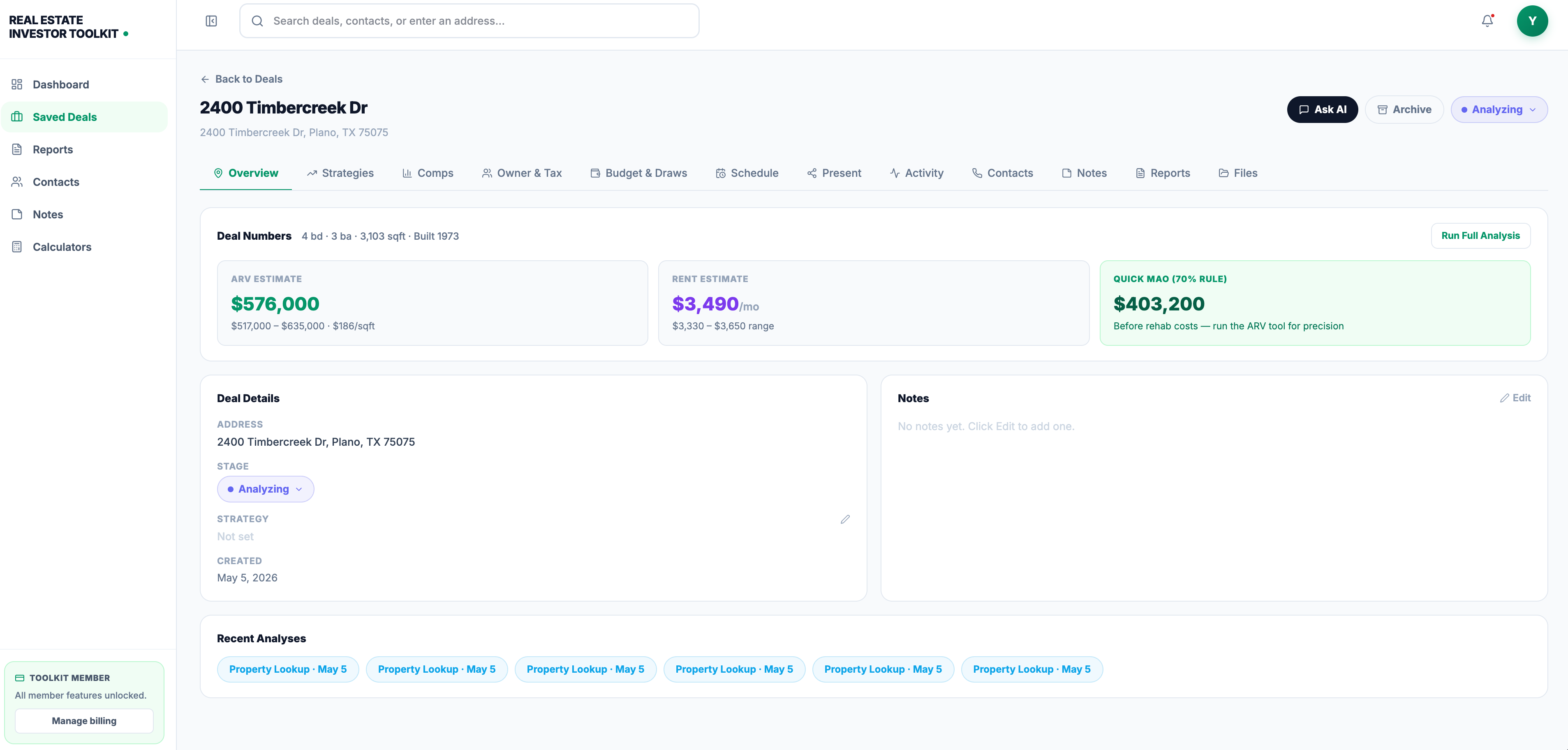
When you are ready to go beyond one-off analyses, the Real Estate Investor Toolkit plan is $39.99 per month and includes unlimited reports, saved deal pipelines, advanced property data, owner-occupancy details and AI chat insights. See the details on the pricing page, or try the free tools first.
A quick workflow you can reuse
- Get the address from the listing or lead.
- Search the county assessor site and copy the APN.
- Save the APN, county and state in your deal file.
- Confirm lot, building and use details against the assessor record.
- Pull comps and calculate ARV.
- Check taxes and assessed value for your carrying costs.
- Ask the planning department about zoning, citing the APN.
- Order title work and, if boundaries matter, a survey from a licensed land surveyor.
This takes minutes per property once you have done it a few times, and it keeps every later number tied to a verified parcel.
FAQ
What does APN mean?
APN means assessor’s parcel number. It is the number a county assessor assigns to a parcel of real property for identification and record keeping. You will often see it on property tax bills, valuation notices and deeds.
Is an APN the same as a tax ID?
Usually, yes. The RESO Data Dictionary lists APN and TaxID as synonyms for the same parcel number field. Some counties also use a separate account number for billing, so confirm in the county’s search tool which number it expects.
How do I find an APN number on my phone?
Open your browser and search for the county assessor’s property search page. Enter the street address, then read the parcel number from the result. You can also check your tax bill or open the county’s GIS map and tap the parcel, as Plumas County describes.
Does an APN prove who owns a property or where the lines are?
No. The APN identifies a parcel for assessment and tax purposes and is not a substitute for the legal description. For ownership, rely on title work. For exact boundaries, Plumas County recommends a licensed land surveyor.
Can two properties have the same APN?
Across the country, yes, because counties issue APNs and formats vary. Within one county’s system, the number is meant to be unique to a parcel. Always pair the APN with the county and state.
Sources
- APN | Wex | US Law | LII / Legal Information Institute
- Parcel Maps | Sacramento County Assessor
- Parcel and Map Numbering System | Carson City
- Maricopa County Assessor’s Office FAQ
- Understanding Parcel Numbers | Fresno County
- Parcel Number | RESO Data Dictionary
- Property Tax Assessment Query | Plumas County